|
|
 |
|
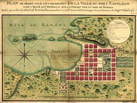
Antique map of Samaná Bay and the Ville du Port Napoléon, proposed by Napoléon Bonaparte I, Emperor of France from 1769-1821. Napoleon Bonaparte I died just three short years before the freed North American slaves, including the Willmore family, emigrated to Samana, D.R. in 1824. |
 |
 |
 |
|
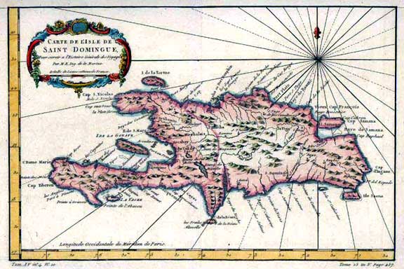
Hand-engraved map of "Saint Domingue", later to be known as the Dominican Republic, produced by Jacque Bellin in 1755 for Prévost's "Histoire Générale des Voyages". Samaná is the peninsula in north east corner of map, below the compass rose. |
| Please click here to return to Samaná, D.R maps. |
| Please click here to return to the Samaná College Home page. |
|
|